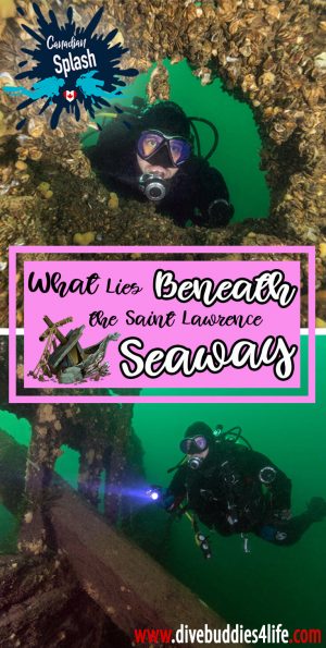
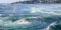
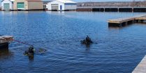
There are a number of reasons why the Saint Lawrence Seaway is considered one of the go-to diving regions of Ontario. Unlike many other places along the cusp of the Great Lakes, this area has a reputation for lacking a thermocline and being on the warmer side of your average Canadian dive site. Not only that, but the riverbed of the seaway is also well known for being littered with age-old shipwrecks, some dating as far back as the early 1800s.
Acting as a bridge between the Great Lakes and the Atlantic ocean, the Saint Lawrence River has been used for centuries as a primary shipping route. Every day close to 15 cargo bearing ships alone travel back and forth along this canal of water, making use of the lockage system to transport goods from the east coast as far inland as Duluth, Minnesota.
The waterway is especially unique in that on top of connecting the Great Lakes to the ocean, it also shares a border with Canada and the USA.
For those who have never tried diving in Canada – relative to its geographical location, my home country is a cold place. Whether your scuba diving in one of our three oceans or at an inland lake, the reality is, you either freeze in the lake’s icy thermocline or opt instead for the ocean’s chilly and productive waters.
Heading underwater in the Saint Lawrence River is considered a special exception in the summer months.

The Great Lakes Diving Guide: This new second edition of The Great Lakes Diving Guide, is the most comprehensive guide ever written about exploring Great Lakes shipwrecks.
In the Saint Lawrence, warm surface waters from Lake Ontario flow seaward into what is known as the Thousand Islands part of the province. As described in the name, the Thousand Islands is a region of endless islands peppered amid a spectacular shoreline. It begins at the mouth of Lake Ontario and stretches for 80 kilometers downstream ending in Brockville.
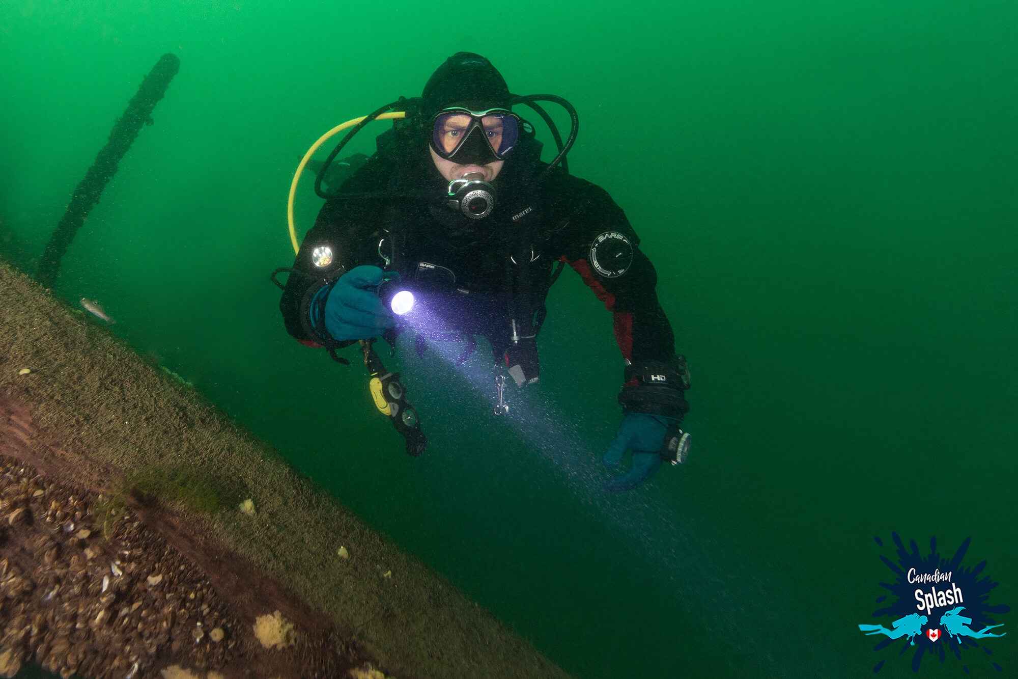
As the heated surface water of Lake Ontario travels downriver through the Thousand Islands, the topography and river current mix Saint Lawrence. This mixing distributes warm water across the river’s water column removing the thermocline. The end result is that in the height of summer, divers can ditch their dive hoods and wear a 5-7 mm wetsuit while exploring the area.
The riverfront city of Brockville and surrounding is a dreamy place. The picturesque location, on the doorstep of the nation’s capital, and Great Lake beauty make Brockville worthy of any traveler’s bucket list.
From lavish brick homes along the water to a charming hometown atmosphere, Brockville works hard at balancing a thriving tourism industry and hospitable community. And while there are no shortages of interesting things to do in this budding Southern Ontario municipality, scuba diving ranks high on the activity list.
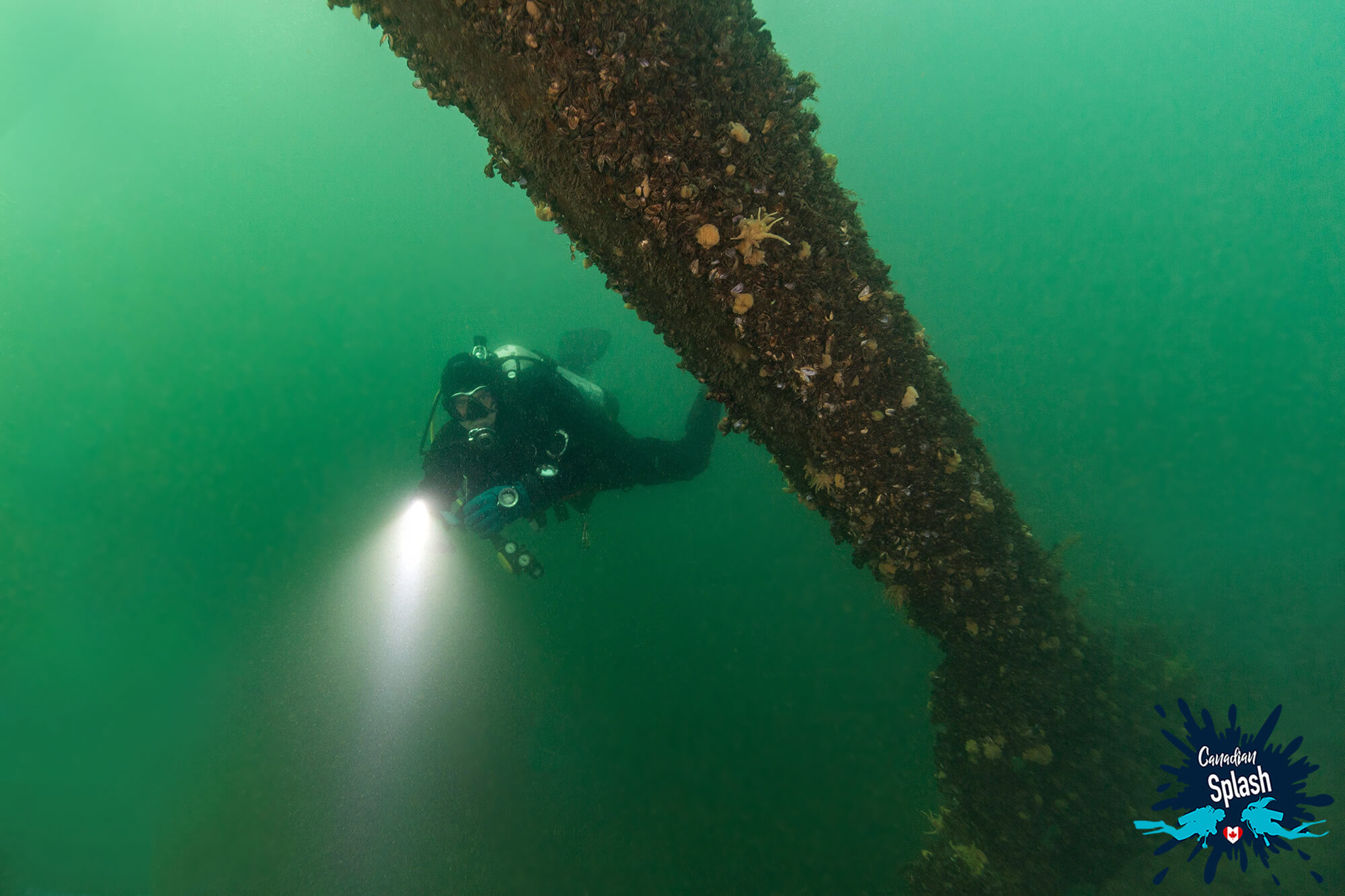
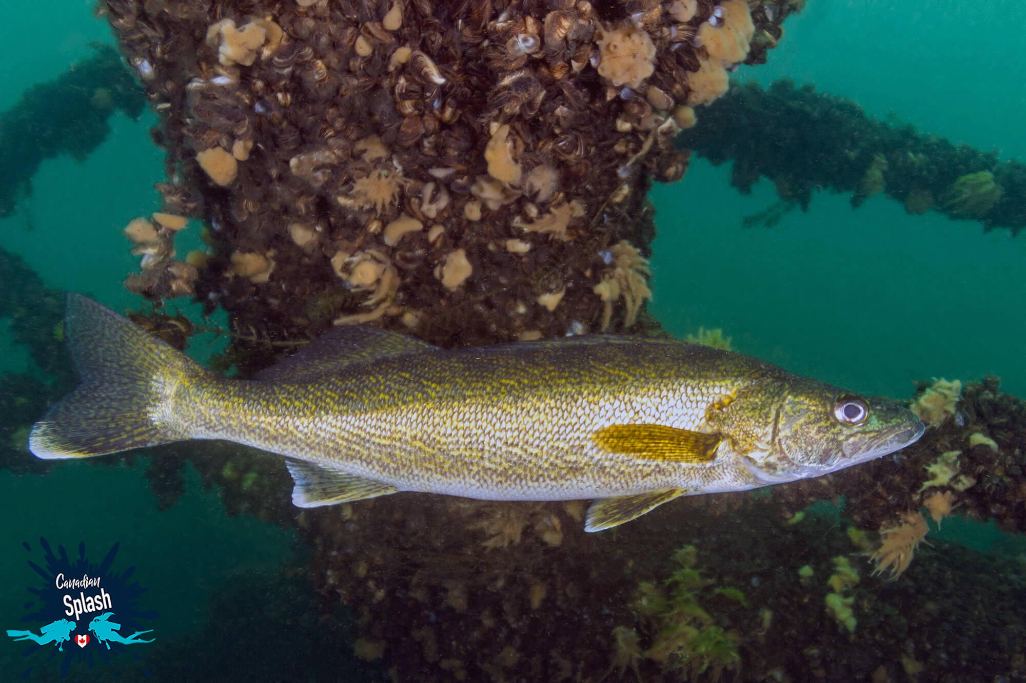
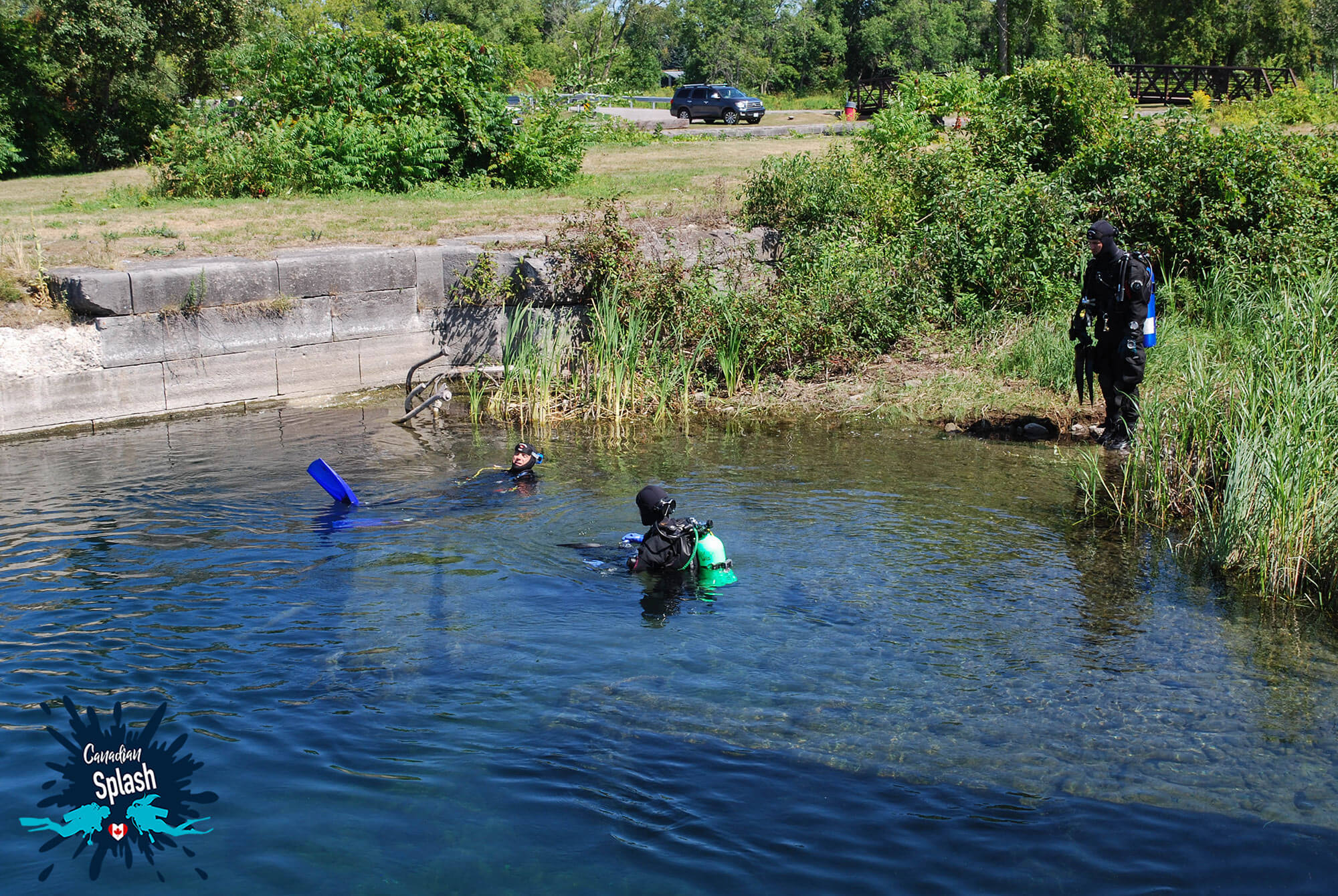
While Ontario has many incredible freshwater diving sites scattered throughout the province, the city of Brockville holds a special place in the scuba community. Along the stretch of river between Rockport and Brockville, there are more than a dozen shipwrecks and drift diving sites to explore. In this southern region of Ontario, divers don’t necessarily need to charter a boat to access great scuba diving, some sites are a mere stone throw from shore. In addition to the many different freshwater fish, divers can find torpedo bottles and clay pipes on the river floor.
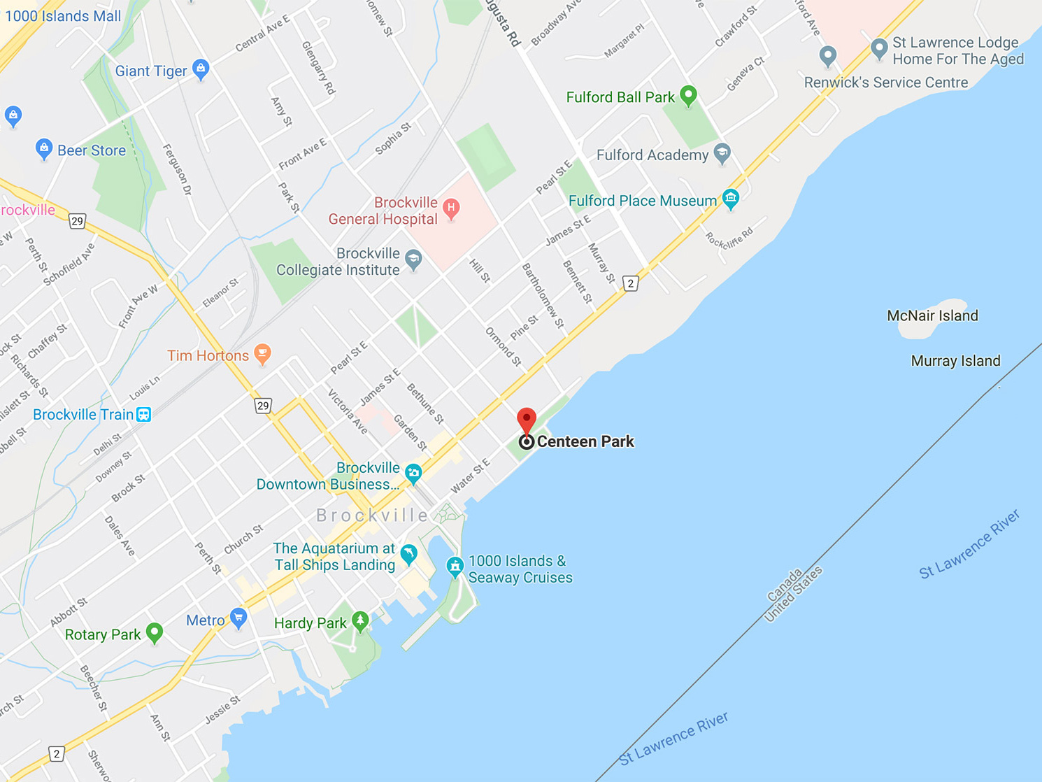
Centeen Park is a recently developed sculpture park directly offshore from Brockville’s downtown riverside.
The sculpture park is a work in progress with art created by local artists Dave Sheridan, Stephen Hatch and students from the Thousand Islands Secondary School (TISS) and Brockville Collegiate Institute (BCI). The statues have been sunk by members of the Save Ontario Shipwrecks Society (SOS) not just as a diving attraction, but to relieve dive traffic on local wrecks.
There are approximately 25 pieces on the river bed and much more in the works. The sunken statues range from standing figures, benches, tables, sea creatures and much more, placed at strategic points within the perimeter of the park.
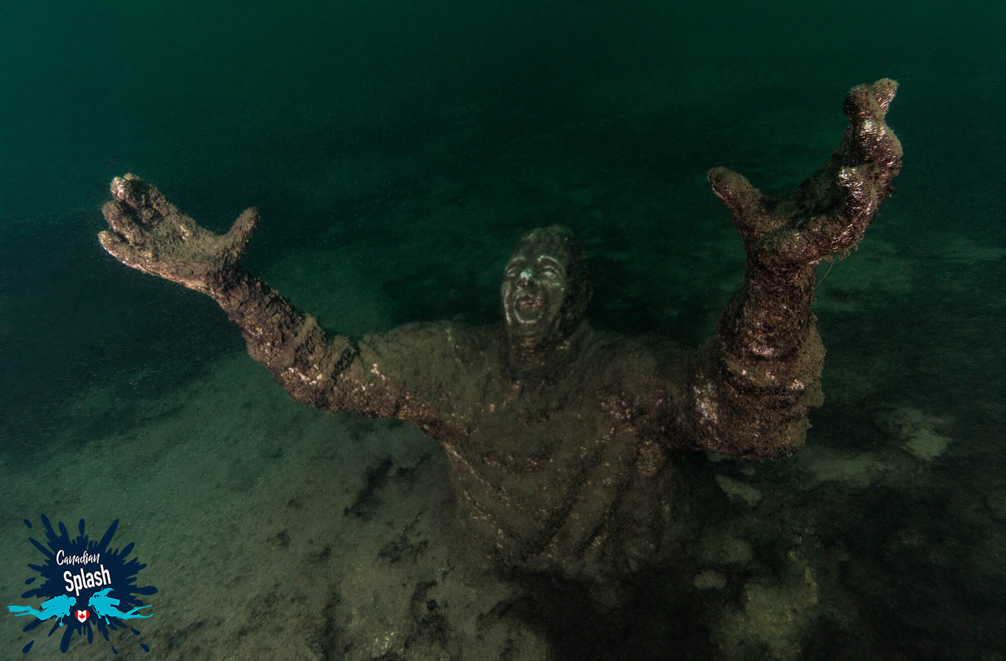
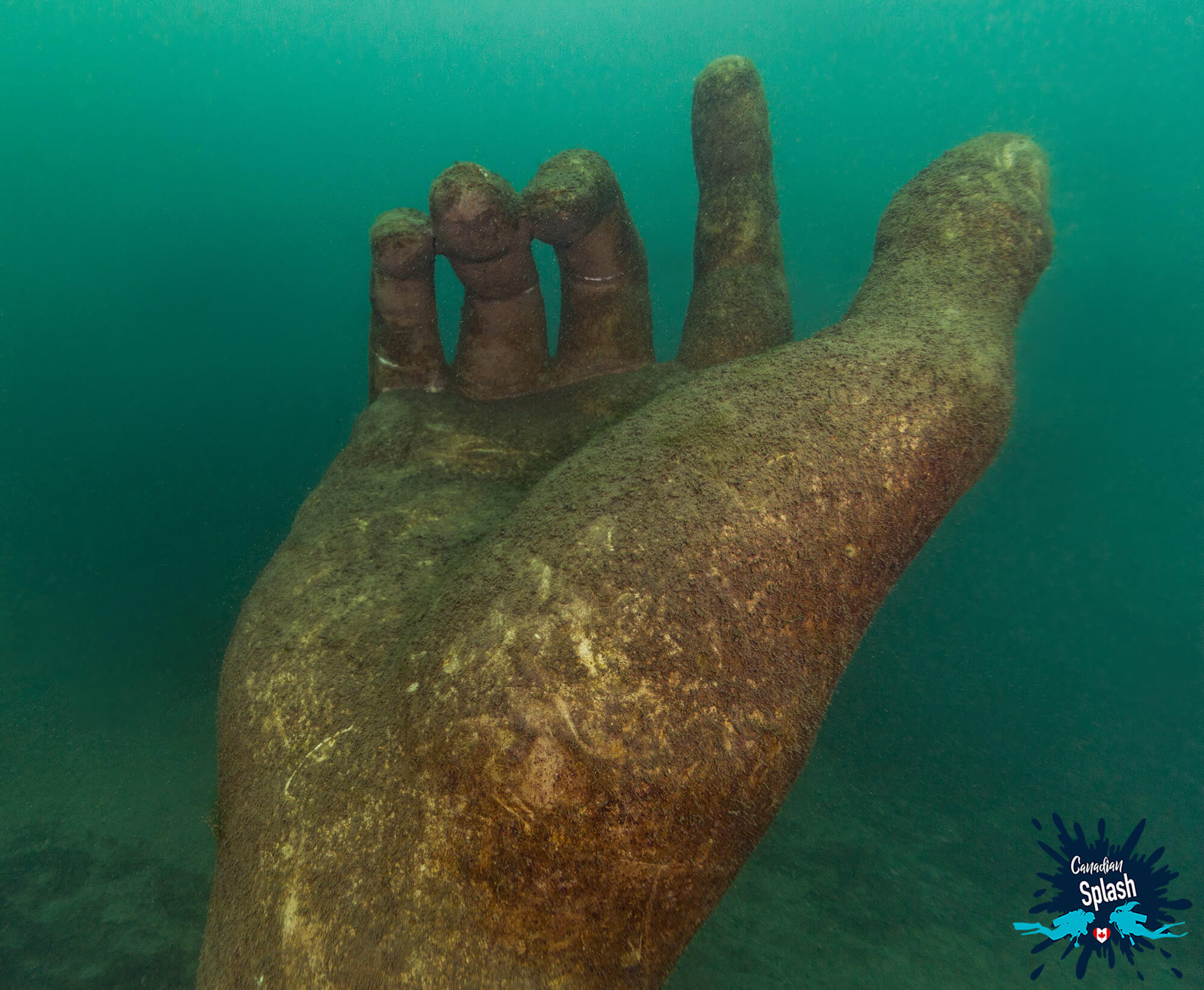
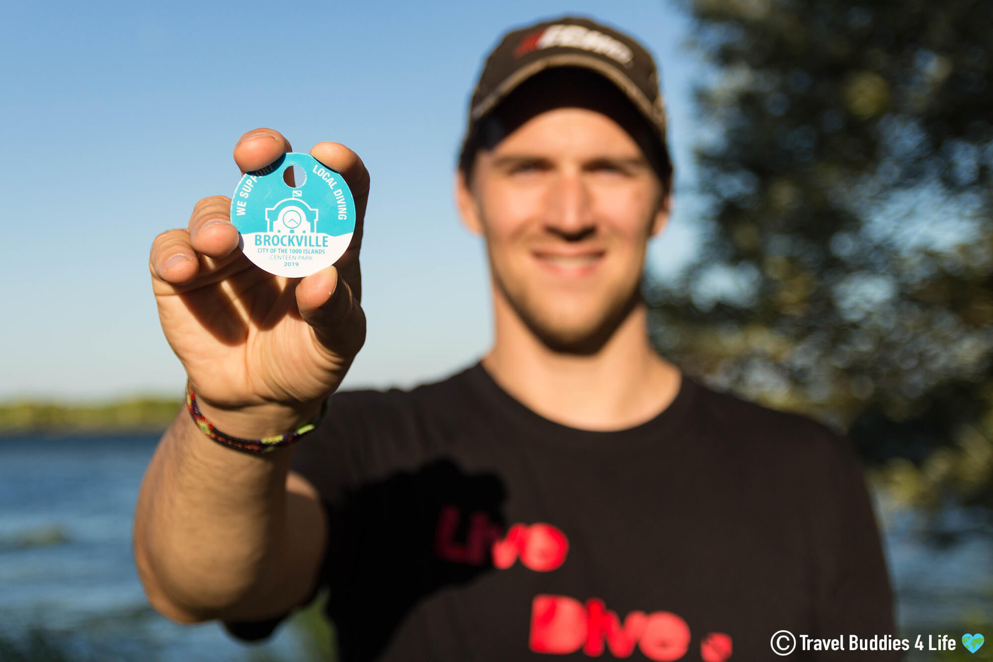
Because of the shallow depth (less than 9 meters or 30 feet), amazing life-size statues and aquatic life, Centeen Park is an appealing dive site, especially for new divers. The park has washroom facilities, metal stairs to enter the water and benches for dive gear set up and tear down. To aid with maintaining and developing the site, divers using Centeen Park are required to purchase an annual dive token at the Brockville Tourism Office, local dive shop or Blockhouse Island tourism kiosk and harbor office.
How to Find Centeen Park and What to Look For:
GPS Coordinates: 44.594045, -75.678295
Address: 70 Water St E, Brockville, ON K6V 1A6
Centeen Park is on the waterfront in downtown Brockville. While there is parking available onsite, this can be limited on busy days and it is recommended to drop equipment then park on King Street.
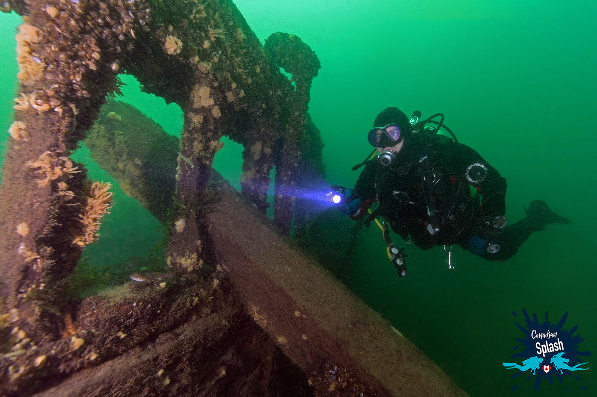
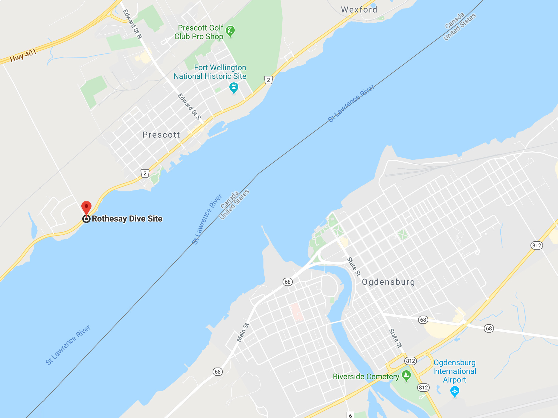
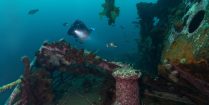
The Rothesay is a 19th-century wooden side-wheeler that initially sailed between Fredericton and St. John, New Brunswick. The wheeler was later relocated to serve on the St Lawrence River. On September 12th, 1889, the Rothesay was ferrying passengers between Brockville and Montreal when she collided with the Myra tug and sank to the west of Prescott.
Since her sinking in 1889, the Rothesay has been used by members of the Royal Military College in Kingston for a munition exercise. This is made evident by the debris field that remains of the once magnificent wooden vessel.
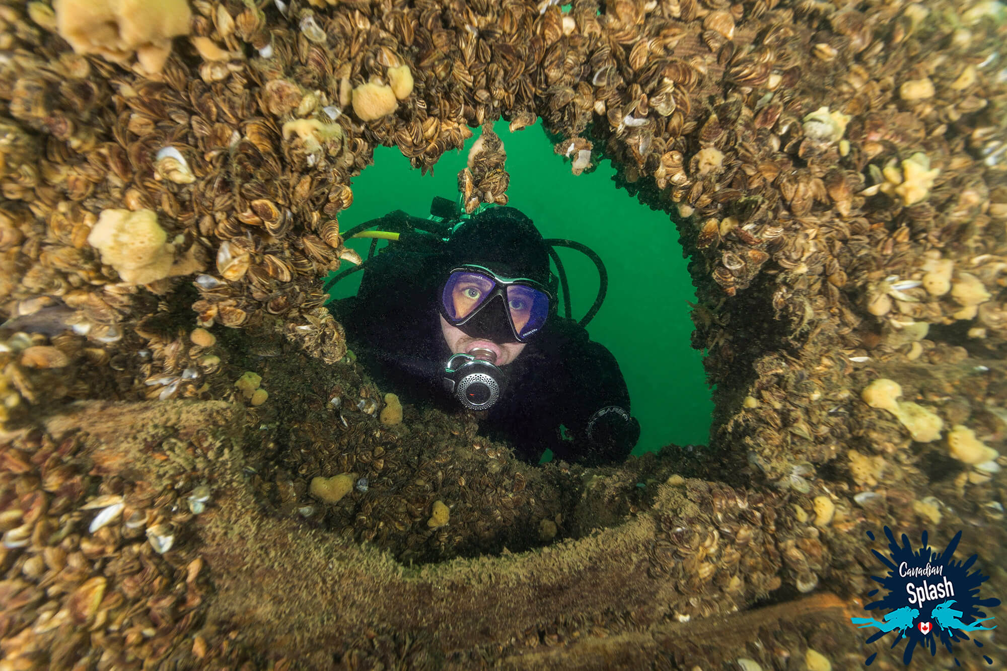
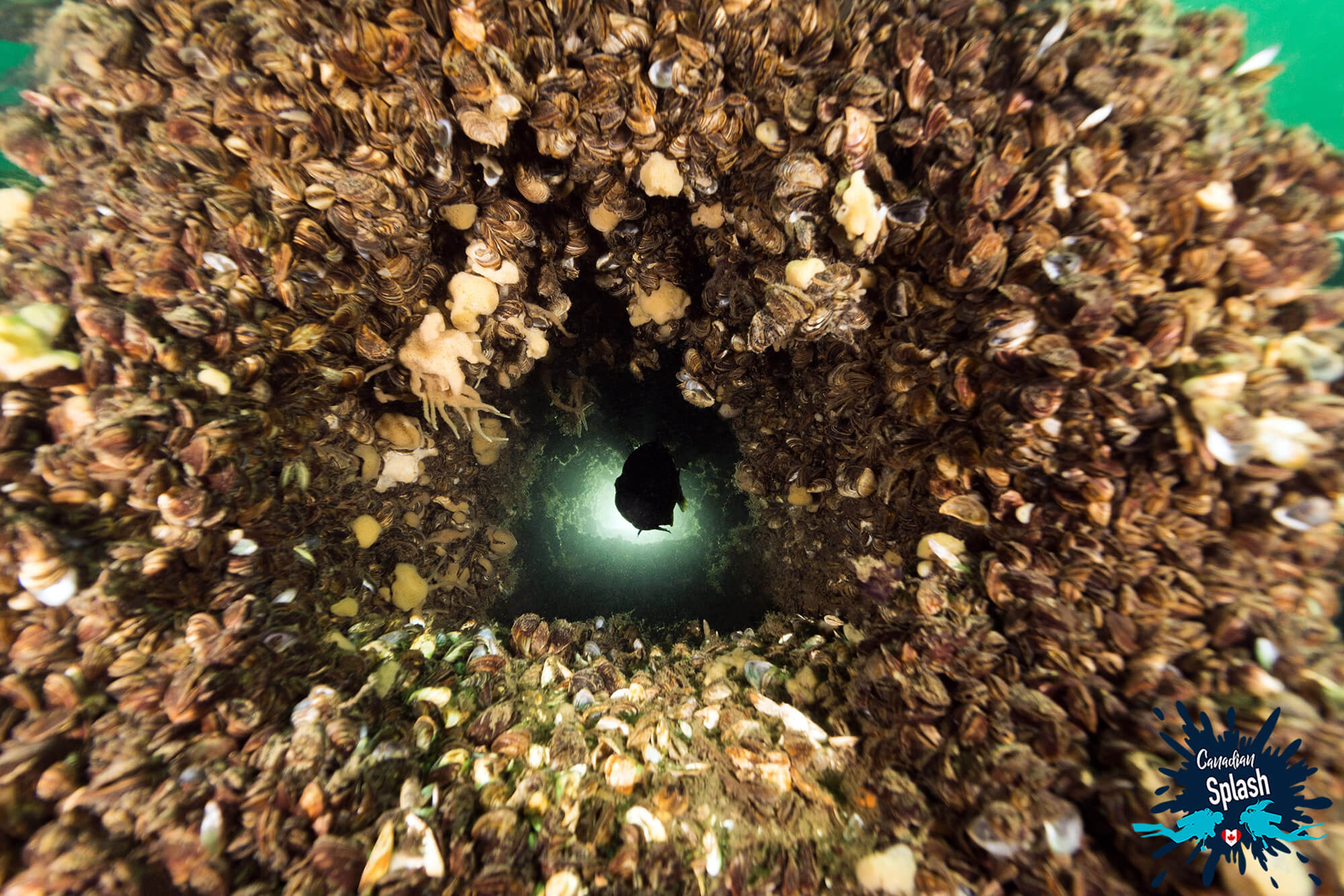
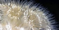
Today, the Rothesay is a 15-minute surface swim from shore. The swim takes divers across gently tapering weed beds which are the perfect refuge for perch, bass, and pike. At nine meters (30 feet deep), the bow of the ship is decorated with colorful freshwater sponges, plant and algae growth.
Most spectacular, however, was the bountiful covering of zebra mussels on what’s left of the hull. A quick glance shows every square inch jam-packed with these razor-sharp bivalves. As some of my images can bear witness, the sheer density is near-indescribable.
How to Find the Rothesay Site and What to Look For:
GPS Coordinates: 44.700854, -75.529674
Address: 1671 County Rd 2, Augusta, ON, Canada
The Rothesay dive site and parking lot is clearly visible from Highway 2. From the embankment a dive buoy 100 feet offshore marks the start of the line out to the wreck.
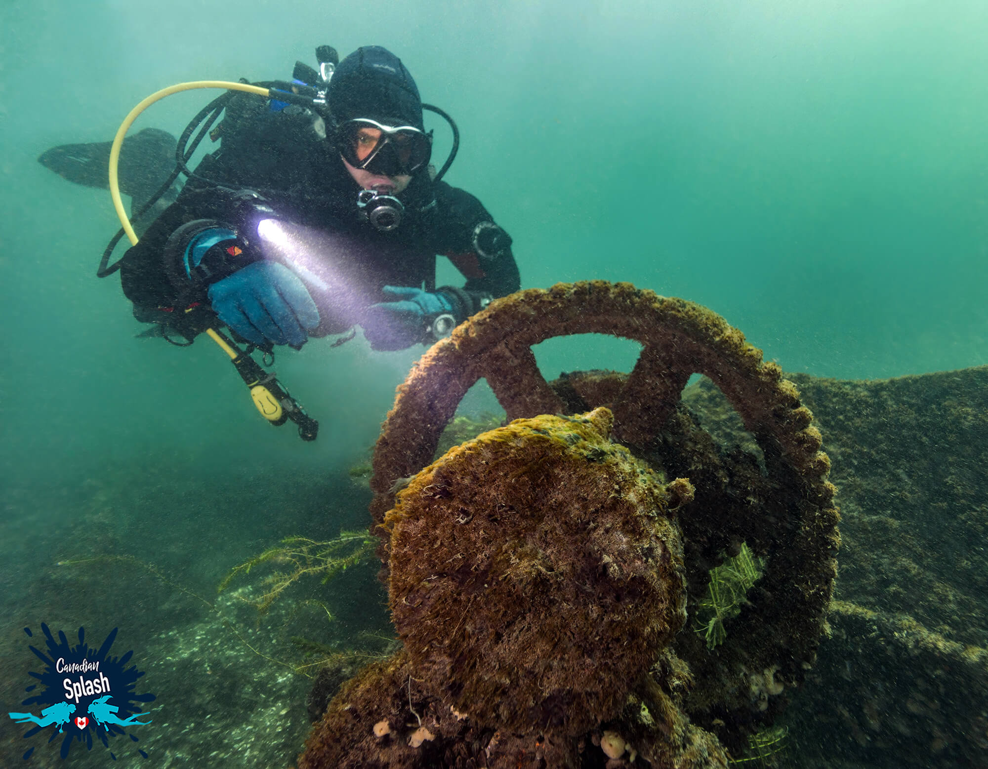
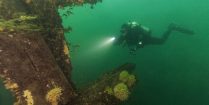
The vintage Conestoga is a 77 meter (252 foot) steamer launched on July 6th, 1878. The vessel was outfitted with steel plates around her hull and powered by a steeple compound engine capable of a speed of 8 knots.
The Conestoga, also known as the Connie, sank on May 22nd, 1922 after a fire broke out in the engine room while awaiting passage. Concerned for the fire damage to the lock, she was flushed from Lock 28 out into the St Lawrence River. The Connie ground and sank at her current location and the loss was estimated at a whopping $200, 000.00.
Now, the Conestoga rests in 9 meters (30 feet) of water in a flowing part of the St Lawrence. The ship is considered a drift dive with flowing current on the outer proximity of the wreck and mild current inside. Looking out at the water from land, divers can easily see the upper steeple of the compound engine protruding out of the river.
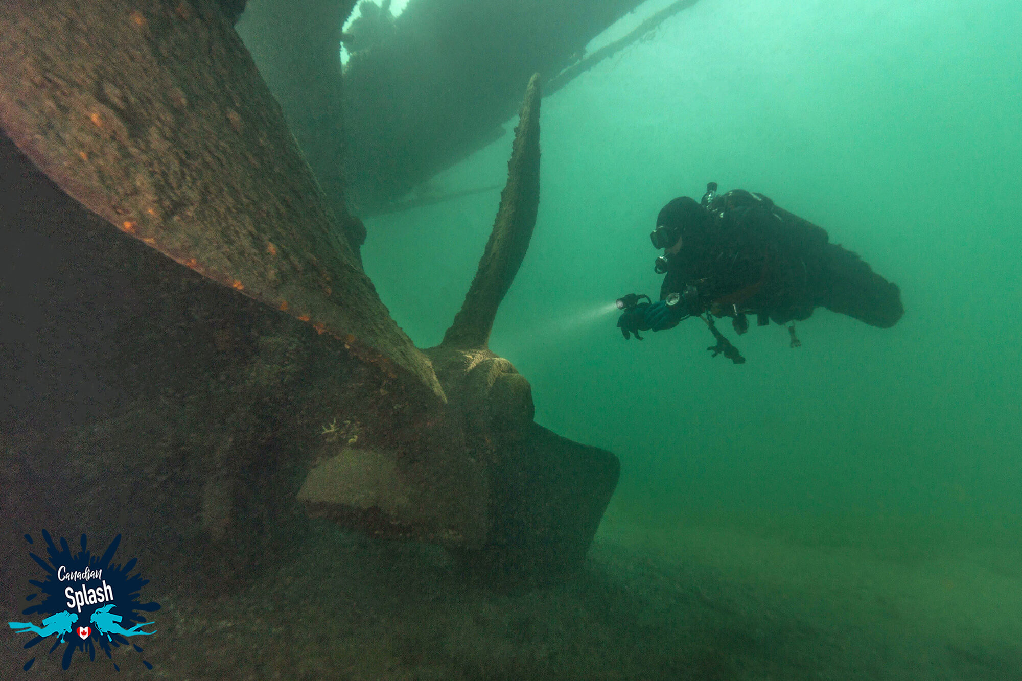
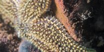
Underwater the Conestoga is an antique masterpiece. The wooden portions of the wreck are still in relatively good condition however she has suffered greatly from looting and wreck stripping. The wooden hull points upstream and is by far the most intact part of the ship. A windlass, winch and anchor chain adorn the bow and are an interesting sight for divers. At the stern, the Conestoga’s most photogenic feature is her 4-meter (14-foot) propeller which has a broken blade and is partially buried in the sand.
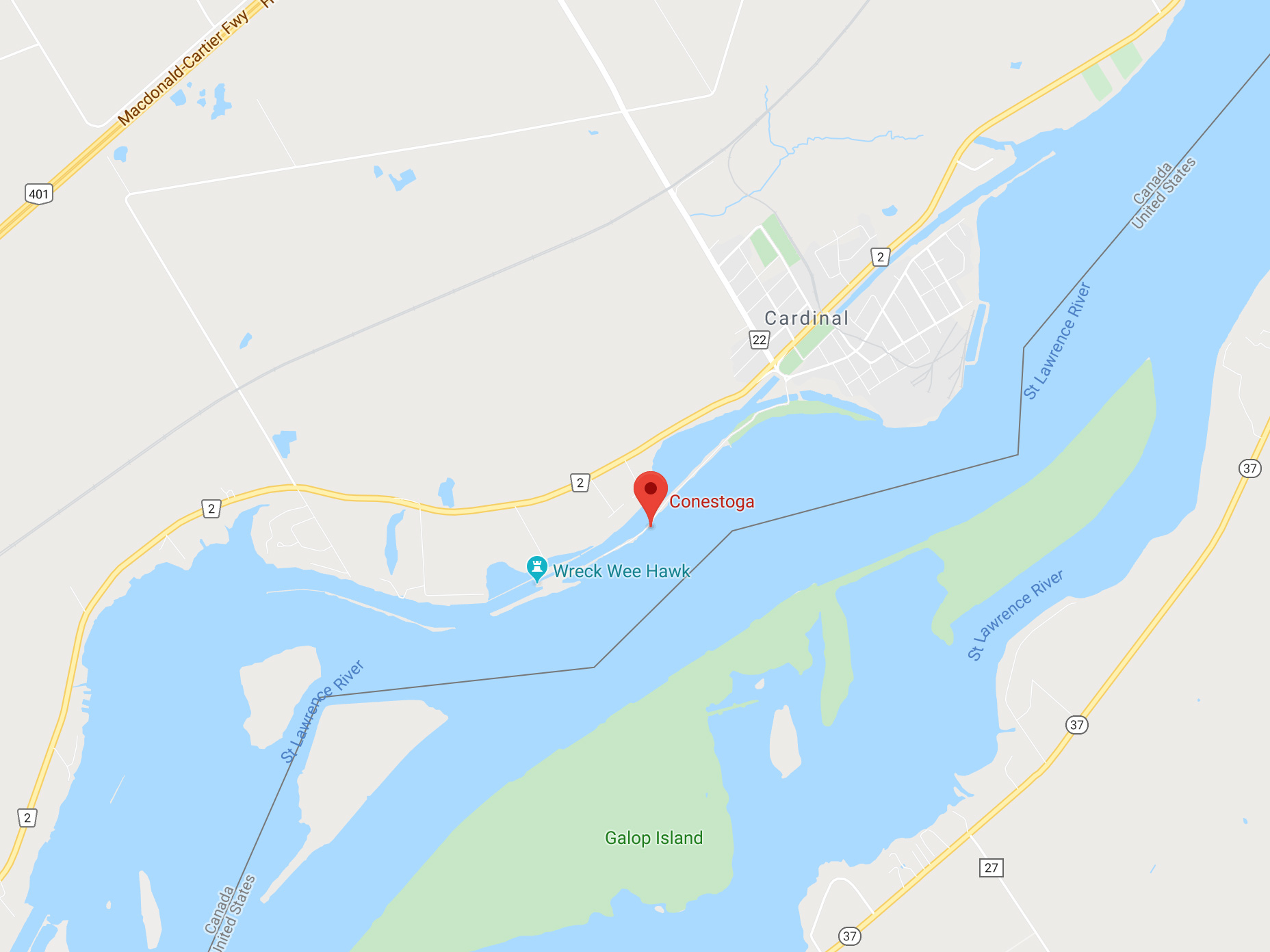
How to Find the Conestoga Site and What to Look For:
GPS Coordinates: 44.782109, -75.392977
Address: Edwardsburgh/Cardinal, ON, Canada
Shore entry for the Conestoga is slightly downstream from the wreck at the information plaque. Follow the dive line down to 6 meters (20 feet) to the bow of the ship.
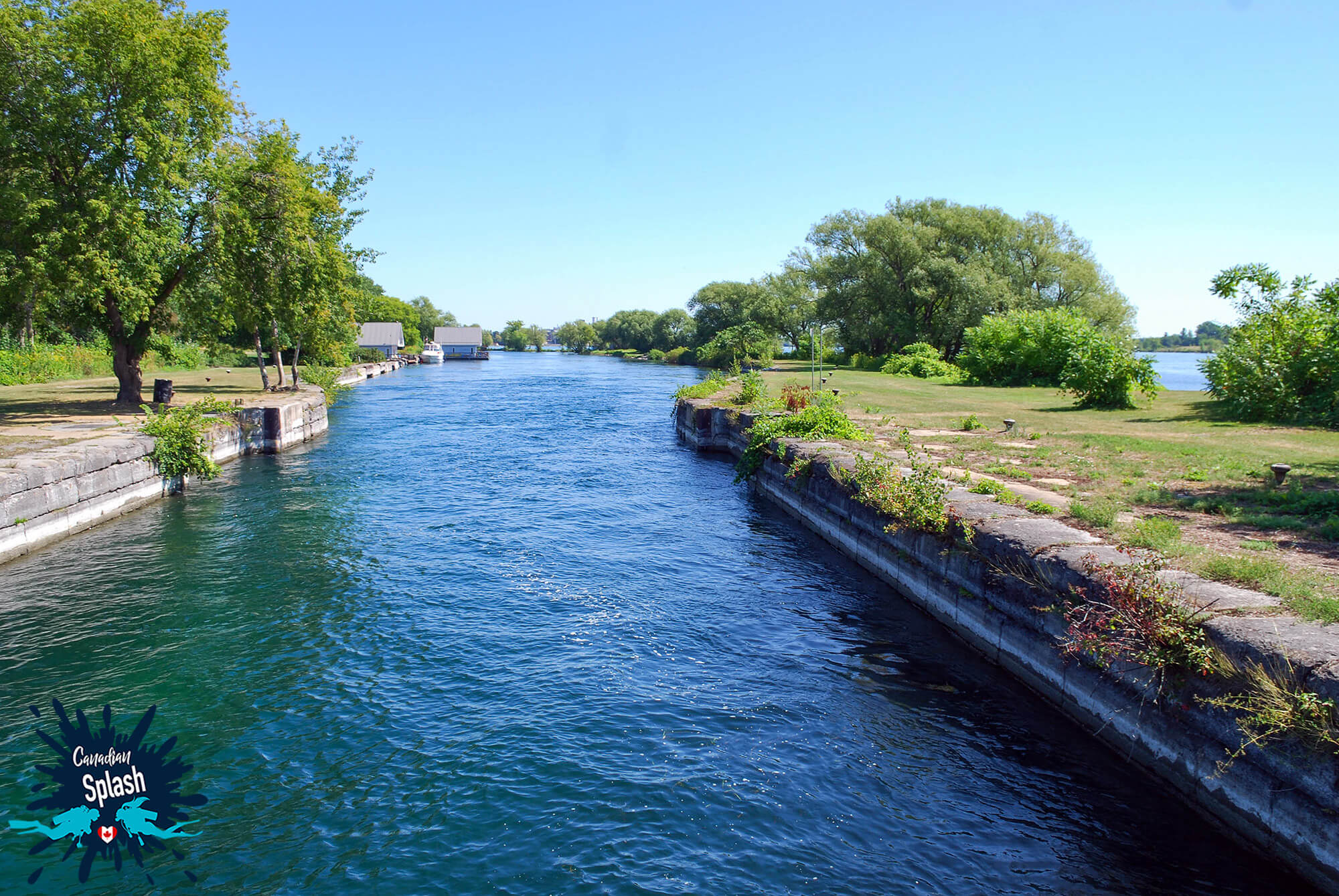
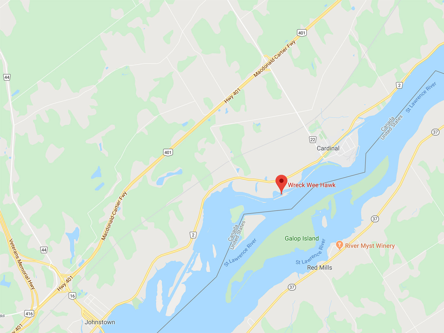
The Weehawk is an old steel ferry that after a long and prosperous life on the water now rests in shambles on the bottom of the Gallop Canal or what use to be Lock 28.
The Weehawk and its sister ship the Walsh were bought by a scrapyard operator, Percy Larose, who operated the scrapyard at Lock 27. Beginning with the Walsh, Percy began scraping both ferries at the old Cardinal Lock but after a severe car accident, which took the life of his wife and left Percy unable to continue his work, the two ferries were abandoned and gradually sunk to the bottom. Between October 10th and November 21st, 1989, the wreckage of the John J. Walsh was removed from the North Side of the locks. The Weehawk remains in its sinking location, upstream from the Conestoga in a shallow 5.5 meters (18 feet) of water.
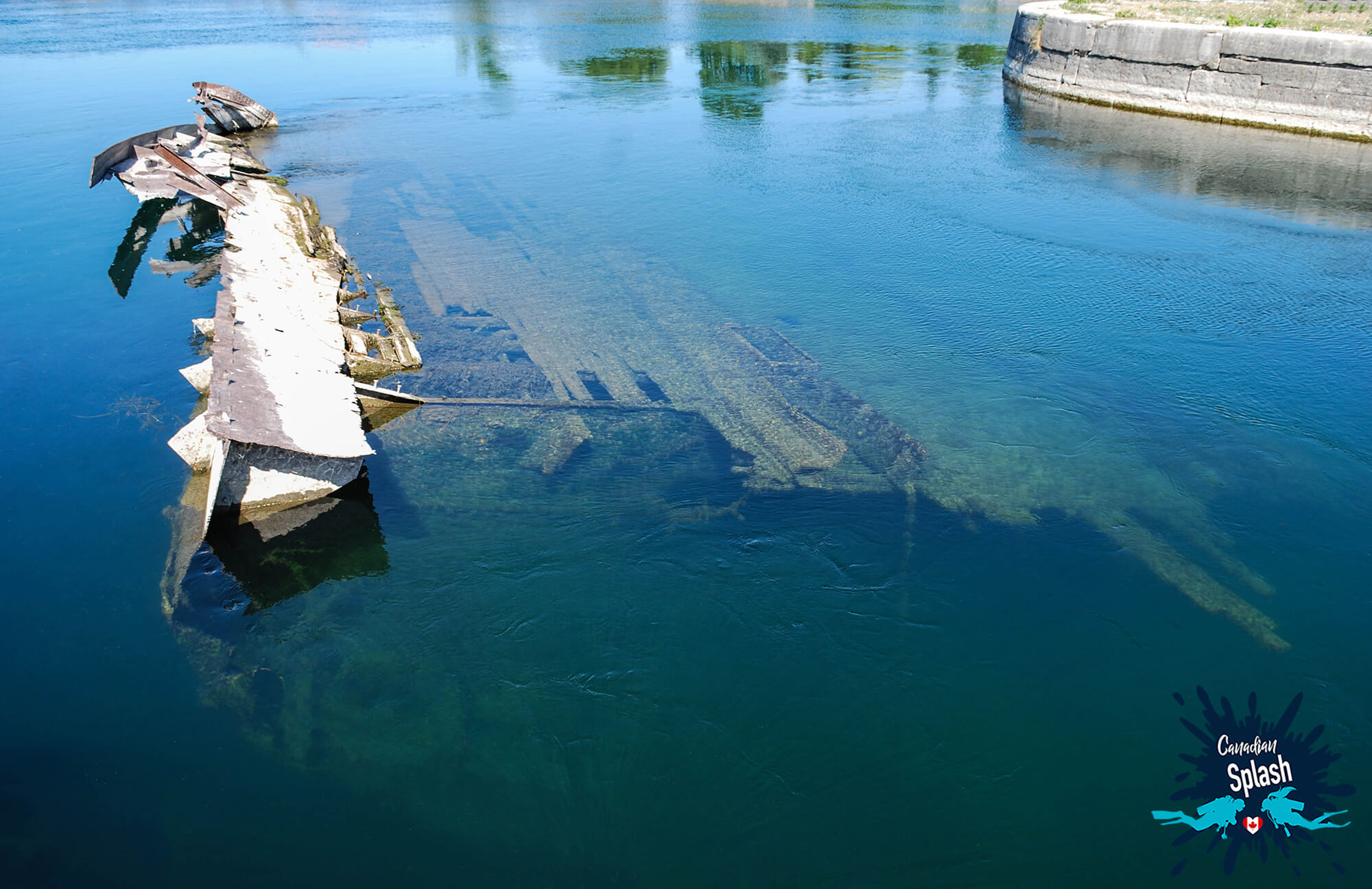
Currently, the Weehawk wreck site is simple to access and a popular drift dive, where divers will enter the water and explore the rusty remnants of the Weehawk then let the strong current suck them down Lock 27 and out into the Saint Lawrence.
A quick walkthrough of the dive site will have divers starting at the Weehawk, where they will often only be able to investigate one side of the wreck before succumbing to Lock 27’s strong current. Divers will then drift down through the confined lock passageway spotting bass and other aquatic life along this speedy lazy river ride. As divers approach the exit to the lock which spits out into the Saint Lawrence, the bottom will become shallow and grassy. This is a queue to kick hard across the mouth of the lock, towards the opposing riverbank where the bottom drops off and becomes rocky boulders. Once on the other side the drift dive typically ends with a quick pass along or through the Conestoga shipwreck.
The great news about the Weehawk/Lock 27 drift dive is that it is relatively easy to do – the whole dive can be done in less than nine meters (30 feet) of water. The drawback is that it is not necessarily an attractive dive site. For one, the Weehawk shipwreck is in skeletal conditions, but also visibility is often poor and the silty riverbed churns up easily.
How to Find the Weehawk/Lock 27 Site and What to Look For:
GPS Coordinates: 44.777296, -75.392566
Address: Highway #2 0.8 kilometers west of Cardinal, Ontario
The entry to the Wee Hawk is at the bottom of Gallop Canal Rd. From the parking lot, walk over the metal bridge following the path to your right. A dive buoy is highly recommended due to boat traffic.
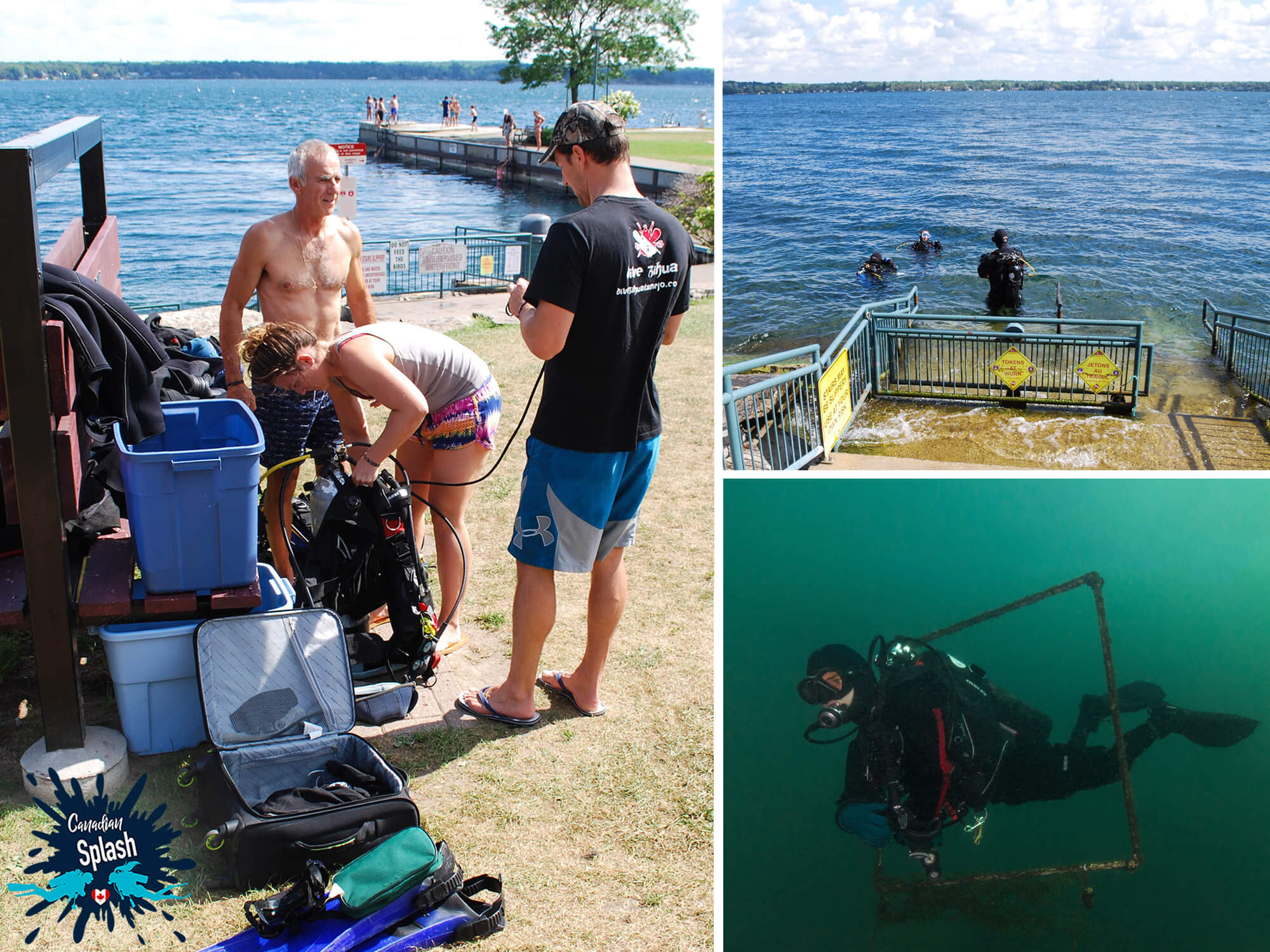
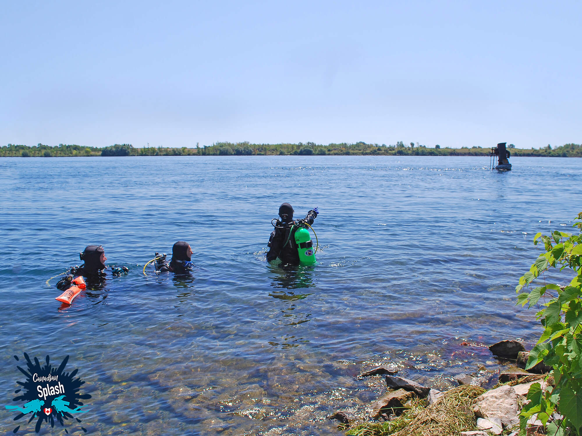
On top of the plethora of shore diving sites the Saint Lawrence River has to offer, Brockville also has a good amount of offshore diving opportunities. To access the offshore diving locations, divers must book a dive charter through a local scuba shop. Boat charters typically offer one, two or three tank dives which vary in location on both the Canadian and US side of the river. For those heading to a diving location across the border, advance registration is necessary and all individuals are required to have their passports on their person.
Not far offshore from Centeen Park, in downtown Brockville, is the two-masted iron rigged wooden barque of the Robert Gaskin. At 34 meters-long (113 feet) the Gaskin was launched on April 21st, 1863 from Kingston and later was outfitted as a salvage barge.
After repeated sinkings and salvages, the Robert Gaskin finally met her fate on September 18th, 1889 when she sunk 18 meters (60 feet) to the river bed while attempting to raise the “William Armstrong” railroad ferry.
For scuba divers, the wooden barque of the Gaskin rests on a firm bottom of clay and silt with her bow facing the shore. When compared to the Rothesay shipwreck, the hull of the Gaskin is in splendid condition with detailed wood railings and large timbers making up her framework. Thanks to the open deck on the vessel, divers could easily sink down into the belly of the boat heading towards the stern and not worry about being in an overhead environment.
Floating towards the back of the ship, the wreck’s condition seemed to deteriorate substantially. It became blatantly obvious that the force of the current and inquisitive divers visiting the wreck, had not been kind of the remaining structure of poor Robert.
The Lillie Pearson shipwreck is located off Sparrow Island and only accessible by boat charter.
This 19th Century Great Lake Centreboard schooler is 40 meters (131 feet) long and built of white oak. With a substantial carrying capacity of 500 ton, the Lillie transported coal, lumber, wheat, barley, railway iron and salt from destination to destination during her lifespan. On her last voyage, the Lillie Pearson hit a rock and took on water due to a cargo shift during a squall. On August 5th, 1877 the Lillie sank upside down in the place she is found today.
In terms of a dive site, the main body of the Lillie Pearson lies in 12-15 meters (40-50 feet) of water, with wreckage and masts extending down to 27 meters (90 feet). The powerful 2-3 knot current, make the Lillie an advanced dive attracting a wide range of fish species who love to hang out in the small cubby holes of the boat.
Typically, scuba divers will be dropped at the upsidedown stern of the Lillie Pearson and drift to the bow. At the bow divers can grab a purposely placed metal chain on the port side of the boat and pull themselves against the ripping current back to the stern. This cycle can be repeated several times so that divers can get a full overview of the wreckage.
On their final pass of the sailboat, divers continue the drift past the Lillie along a rock wall looking for the safety stop line which they can follow into a sheltered alcove.
Ontario is a province that attracts a substantial amount of cold water divers every year, mainly because of its shipwrecks and sunken towns.
And like much of the Great Lake region of this province, the Brockville has an impressive array of diving attractions. Many ocean-going vessels used this seaway known as “Highway H2O” to get to and from the Great Lakes, running aground or sinking in the process.
But what makes Brockville so appealing as a dive destination is not just the age-old wooden shipwrecks. It’s the ease of accessibility, variety of fish life and diversity in diving opportunities. From drifts, to shore dives to sunken statues, the region is chock full of watery goodness.
For More Ontario Scuba Inspiration Read About Diving our Provincial Parks:
When it comes to getting immersed in nature, Ontario Parks is at the top of the list. Not only do the parks boast wildlife, but it’s hundreds of thousands of lakes make it a real treat for those who love the water.
Have you ever explored the emerald waters of the Saint Lawrence seaway either from the Ontario or New York side? What did you think of the wreck diving?
Writers Note: This post may contain affiliate links. We will make a small commission if you make a purchase through one of these links, at no extra cost to you. See full disclosure and disclaimer policy here.
A special thank you goes out to Bonny Perron for photographing and providing us with land based images for this post. Want to explore more diving in Ontario? Take a look at H2O Ontario to discover more interesting Ontario-based dive adventures.
PIN ME FOR LATER
CONNECT WITH US
Colouring Book
Book a Dive Trip

Travel by Land

Shop Dive Gear

CATEGORIES


When it comes to getting outside and immersed in nature, Ontario Parks is at the top of the list. Not only do the parks boast magnificent nature, but it's hundreds of thousands of lakes make it a real treat for those who love the water.
Do you want to try diving inside an aquarium? This unique Canadian location lets you experience scuba diving and up-close animal encounters like never before.
Saint Andrews by-the-sea may be small in size, but this summer town packs a pretty big dive punch for scuba divers willing to brave the Bay of Fundy's tides.
Nova Scotia is full of cold water diving opportunities, particularly around shores of Halifax.
When diving in Nova Scotia where do you even begin? Do you start in Halifax the province's capital or do you wander beyond to see what the surrounding area has to offer?
Sometimes finding a good dive spot is easier said than done. Shore diving around Saint John, New Brunswick is a testament to how unpredictable the Bay Fundy can be.
Submerging into the cold waters of Deer Island is one of the best ways to appreciate the vibrant array of color the Bay of Fundy hides beneath her surface.
Do you enjoy cold water wreck diving? This dive destination will let you experience the best shipwrecks and scuba diving opportunities on the Canadian east coast.
From age-old shipwrecks to lukewarm water, the Saint Lawrence Seaway is considered one of the go-to diving destinations in Ontario.
Find out how a couple of scuba divers made a gigantic snow sculpture to try and turn the tides on plastic use in the city of North Bay.
While most people were at home celebrating Mother’s Day, the North Bay Scuba Club donned dive gear and took to the water to clean up the local marina.


